
Met Éireann hint at return of major cold snap as they warn of 'Atlantic regime'

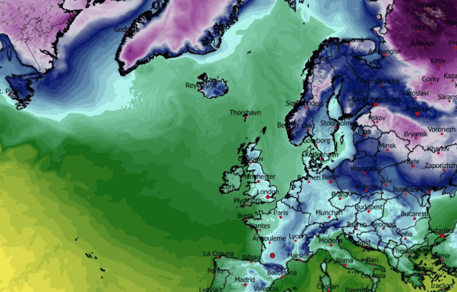

Met Éireann's weekend weather forecast continues largely cool and unsettled with an even further cold spell potentially on the way
Met Éireann has hinted at another major cold spell on the way for Ireland as they delivered their weather forecast for the weekend and beyond towards the end of January.
Their outlook says: "Over the next few days we'll see cooler days and chilly nights with frost, ice and freezing fog. With low pressure staying nearby we'll also see further outbreaks of scattered showers as well as persistent widespread fog."
Beyond the next few days, they stress the "uncertainty in the forecast" but continue to point out that "current indications suggest unsettled conditions will continue as a mobile Atlantic regime remains in charge. There is also a signal for cool or cold weather to return."
Between now and then, conditions will remain unsettled and cool. The Met Éireann forecast for Friday night reads: "Tonight will be dry for most with scattered showers mostly keeping to coastal fringes. Mist and fog will develop overnight, becoming widespread by morning under mostly calm conditions. Frost and ice will form under any clear skies with lowest temperatures of -2 to +3 degrees, mildest in the northeast."
The forecast continues for the coming days:
"Areas of mist and fog to start on Saturday, lingering for a time, but otherwise it'll be a generally dry day with some bright spells. Scattered showers will be mostly confined to parts of the east and north, with the odd shower possible elsewhere. Highest temperatures of 4 to 8 degrees in light southeasterly or cyclonic variable winds.
"Mist and fog will linger in places, but it will remain generally dry for the earlier half of the day [on Sunday], with brighter breaks further east. Through the afternoon, rain and drizzle will feed in over western counties and gradually clear eastwards overnight and into Monday morning. Highest temperatures of 6 to 9 degrees in light to moderate southeasterly winds. As rain continues to move in overnight temperatures will be relatively milder with lows of 2 to 6 degrees in moderate southeast winds."